Now that I am full grown, I enjoy hiking and camping and such...but hiking for a couple of days is a little more intense. You have to carry everything you need and our packs weighed in at about 45 pounds.
We decided to start at the beginning of the trail since the person we were hiking with had a place near Springer Mountain in Georgia. In the pictures below you can see the house of the guy (who is a total badass and built this house literally by himself) and the place to put into the trail which is at the base of Springer Mountain.

We had to hike south to get to the start of the trail (although many people put in at Amicalola falls which is 8 miles past Springer Mountain, the trail technically starts at Springer Mountain) before we could hike north to our final destination.

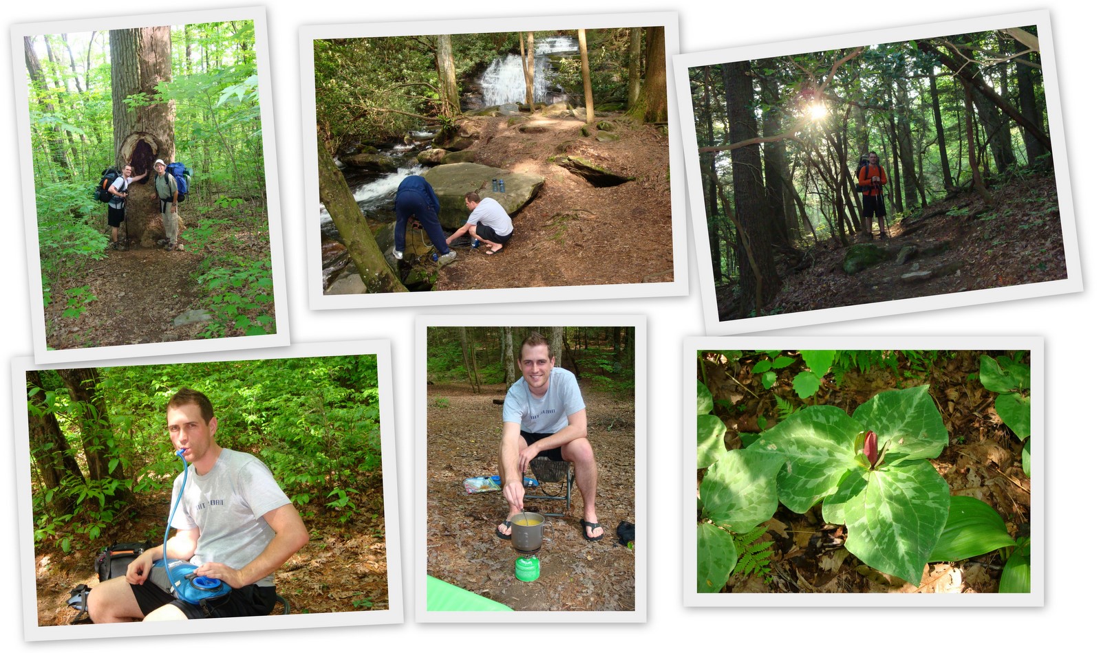
On the first day we took it easy and only hiked five miles. It was a good idea because at about the five mile mark is a nice little waterfall.

On the first night we elected to sleep on a slight slope because it was supposed to rain and all of the flat areas looked like a place where the water would build-up if it rained. Aftre tossing and turning all night and with sore backs the next morning...we learned that sleeping on a slope is a bad idea.
Anywho, the next day we got up nice and early (which means we got to sleep in until 8 AM) so we could do our daily ten miles. We decided after a couple of days that we probably could have planned for 12 miles a day and still felt like we could take our time and enjoy ourselves, but we planned for ten so we stuck with ten. It was actually nice because we never had to rush. If we wanted to break or stop and get pictures, it was no problem. If we hiked straight through we usually finished at 3-4 PM and it got dark after 7 PM.
On the second day as we walked over a nice little climb I saw a bear cross the path about 30 yards ahead of me. I also learned (from seeing it everywhere) that a bear, does in fact, shit in the woods. Well as the day wore on everyone we passed was talking about the bear problem in the upcoming areas. Apparently there are a couple of bears that have learned how to tear down bear bags (where you hang your food from a tree so they don't eat it).

- Bottom middle: Here you can see our bear bag handing from a small tree.
Well we had no incidents the second evening but we were not really in the problematic bear's territories yet. The third day was all about prepping for Blood Mountain. Blood Mountain was probably the toughest climb we had on the 50 mile stretch we chose and we wanted to stop short of the Mountain so we could tackle it in the morning. Problem was that the shelter we planned on stopping near was where the bears had recently been active. These bears ripped down permanent steel cables that were designed to stop bears from getting to your food.
This led to everyone on the trail stopping way short of Blood Mountain...so we ended up camping with about 17 other people and this is not common when hiking on the AT.

- Bottom left: We forgot to get a picture but you can still sort of see some of the other tents of the people we camped near.
Once again we had no bear troubles so we started to climb Blood. Turns out Blood was no big deal. I won't say that it was not challenging, but at this point with a couple of days under our belt we were in better shaped and just raced up the thing.

The amazing thing is that at the top of Blood Mountain is a shelter that was built by the Civilian Engineering Core (government work to restart the economy during the depression in the 1930s). People had to haul all of the stones and mortar necessary to build a structure up that mountain (I'm sure they used rocks from up there but mortar requires water). It is still looking good today, about 80 years later, and I'm sure that it has helped many a stranded hiker.
After Blood we hiked down to mile 30, where the trail passes through a store that has a ton of hiking gear as well as ice cream (we had been talking about mile 30 since mile 1). After a short break we walked another 2.5 miles and then decided to walk back to mile 30 and end our trip early. My Dad's feet started blistering on the first day and despite all of our efforts to tape and bandage them we decided the best thing to do was to get his feet some rest. It turned out to be a really smart thing since it poured rain that night (we had no rain during our four days...simply glorious weather) and the wet shoes certainly would not have helped his already bad feet. He ended up loosing his baby toenail because he had a blister all around the nail and under it and this also reaffirms that we made a good decision.
When we got to mile 30 we had a shuttle (and the driver and his dog were quite a pair) take us back to the cabin, showered for the first time in a week, and went into town for real food.

- Middle left and right: People tossed their old shoes in the trees and lines hanging inside the store at mile 30 so our friend contributed his shoes (which were loosing their soles) from the trip.
Overall it was a fantastic trip. You could not have asked for better weather, the sites were gorgeous, and it was a fun and challenging event. Hopefully I can find some time in the upcoming years to do another week.